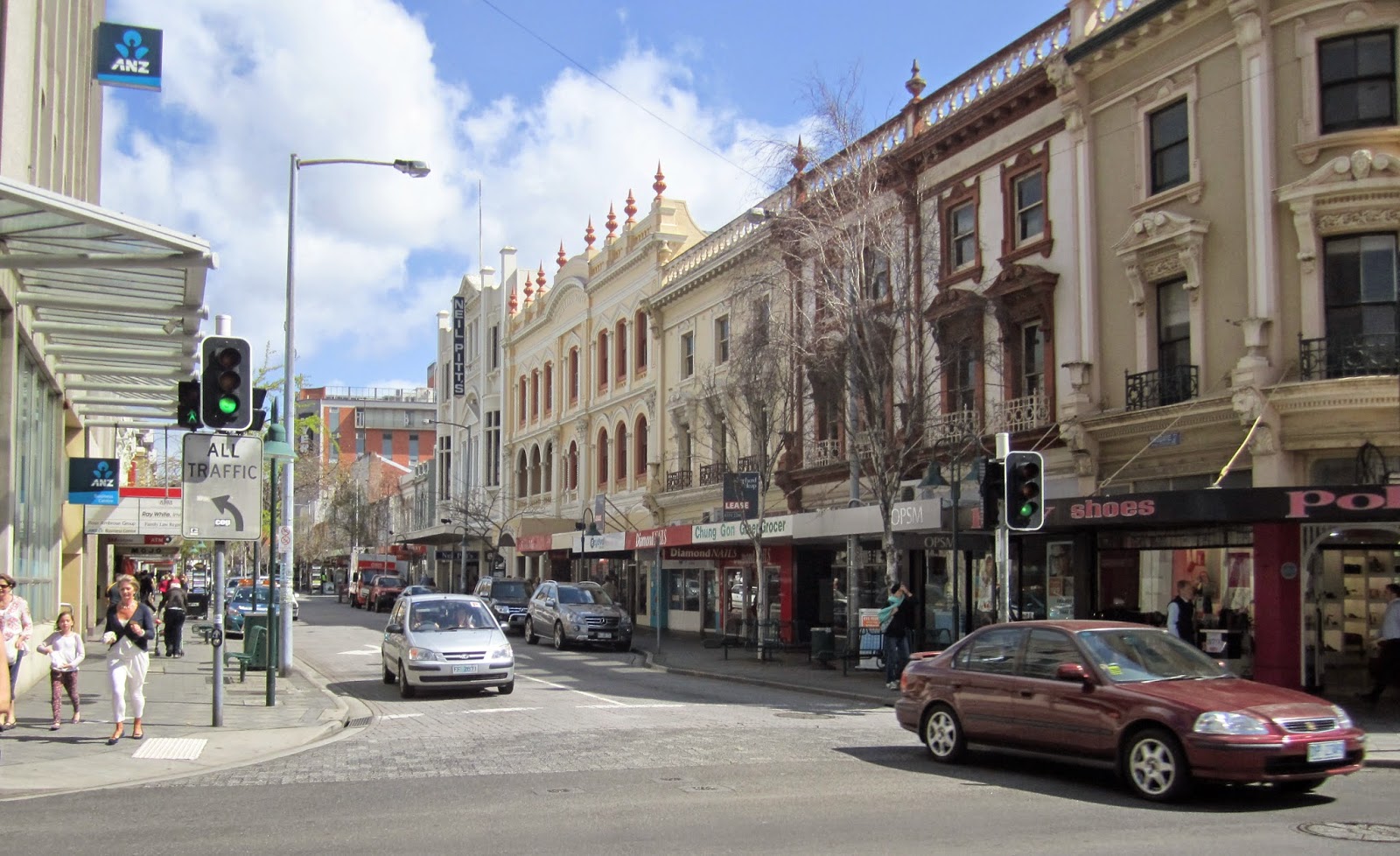
Saturday, 29 November 2014

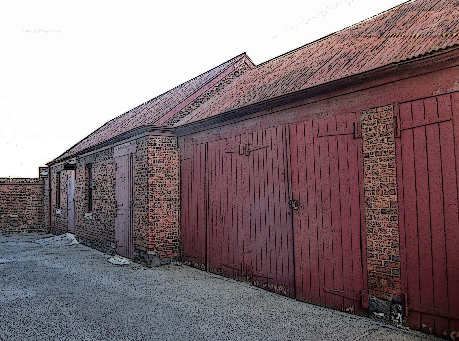
STABLES - 22 WELLINGTON STREET

STABLES ON BAPTIST CHURCH SITE, WELLINGTON STREET
In the late 1850s Henry Davy Parr took over the Royal Hotel at 22 Wellington Street (currently the Baptist Church Offices – see last week's post). 

 He is reputed to have spent some two thousand pounds developing the site, building stables in 1857, and making other improvements, and the establishment became known as “Parr's Family Hotel”.

Henry Davey Parr was a remarkable man. His obituary, published in The Examiner on 01 February 1878, is well worth reading. It omits to mention Parr's passage to Tasmania (compliments of the British government – he arrived as a convict in 1833). Apart from “publican” Parr was variously a farmer (at Westbury), veterinarian, horsebreeder and trainer, owner of the Mowbray racetrack, and proponent of a (sadly) ineffective cure for cancer!! He seems to have been well-respected and liked, renowned for his “smiling countenance.” Prior to the Royal, Parr was licensee of the Australian and Tasmanian Hotel, the Queen's Head Hotel (also in Wellingon Street), and afterwards, the Post Office Hotel, and Temperance Hotels in Paterson street.

Parr's hotels were not favoured by dedicated drinkers and were thus known as a comfortable and safe place to stay. This was particularly notable at a time when many of the residents of Wellington Street were said to be too scared to venture out after dark!

Parr continued to operate the hotel until the 1870s when it was purchased by Henry Reed who was keen to establish an evangelical mission to the people of Launceston. More next time........

Saturday, 22 November 2014

THE BAPTIST CHURCH OFFICES - 22 WELLINGTON STREET

THE BAPTIST CHURCH OFFICE TODAY

This is the first of four postings about a remarkable set of buildings located at Wellington Street Launceston.

Before it became the Baptist Church Office, the building at 22 Wellington Street, between the Church and Regal Press was initially a house, but for many years after that operated as a hotel.

I haven't been able to find out who undertook the initial construction or when it occurred, but an article in the Cornwall Chronicle of September 26th 1846 makes mention of Benjamin Hyrons building a “substantial and lasting structure” in the vicinity of Charles and Wellington street so it seems probable that he may have been responsible, especially as when the house was converted to an inn in 1851, Hyrons was granted a license to operate the business under the name of “The Royal Hotel”.

An interesting biography of Hyron, an ex-convict who established an extensive business network in early Tasmania, and whose broad interests included many inns in both the north and south of the state, as well as early transport and mail services can be found at http://innshumpagegoodegreenwell.familytreeguide.com. Benjamin Hyron's enterprises, included stagecoaches which left from the Royal Hotel immediately after steamers from Port Phillip arrived in port. He offered to deliver his passengers to Hobart within twelve hours.

In 1853, the hotel was advertised for sale, as was Hyron's brewery which was probably also located on the site. According to QVMAG's informative article about Launceston's industrial heritage, Hyron offered “the best ale in Launceston” for sixpence a quart if customers brought their own vessels.

Other proprietors followed Hyrons, but the next licensee of note was Henry Davey Parr, who developed the site further, and added the stables – the second oldest structure on the site. More about him next posting....

Note: Its been very hard to get a photo of this building without it being obscured by vehicles, even in early morning semi-darkness! Then there are telegraph poles obscuring the front, wires everywhere etc etc etc. I have had a bit of a go at doing something presentable, but fortunately the lovely Lee, who has had a long association with the Baptist Church not only provided lots of useful information to use in this series, but also some photos taken during the early days of the church, which give a much better view of the building.

AN EARLY PICTURE OF THE ORIGINAL BUILDING AND NEW CHURCH

Saturday, 8 November 2014

POST OFFICE CLOCK - 68 CAMERON STREET

The clock on the Post Office celebrated its 100th birthday in 2010. 

It was installed some 17 years after the post office, at a cost of 1300 pounds, after a campaign of public fund raising. According to a report in the Daily Telegraph, there was a real desire to have the clock manufactured in Australia but it was not economically viable to do so, and it was made by Gillett and Johnson in England. An official unveiling ceremony was conducted in July 1910, and a “toast was heartily drunk.” A plaque was provided by the building firm J & T Gunn which read: Launceston Centenary Clock and Chimes 1806 – 1906. Erected by public subscription in the reign of Kind Edward VII to commemorate the first centenary of the City of Launceston in Tasmania.”

The clock has been a landmark of Launceston ever since. I remember trips to the city when I was a child and the sound of the clock was second only to the wonders of the Myer escalators in my inventory of “the wonders of the big city.” There was some fierce debate around 2011 as to whether the clocks chimes are “too loud,” and should be silenced at night. You can read an opinion in the negative at http://tasratepayers.blogspot.com.au/2011/07/launceston-post-office-clock-to-silence_09.html. I have to confess that I don't know whether or not the clock is still keeping tourists awake at night but I can vouch for the fact it still chimes during the day – I'm the figure scurrying across Wellington Street trying to get back to work before it strikes one!!

Tuesday, 28 October 2014

CIVIC SQUARE - MACQUARIE HOUSE

Macquarie House - Civic Square

Macquarie House at 92 -94 Cameron Street was built by John Sprunt (who also built the Red Feather Inn at Hadspen), for Henry Reed in 1829 - 30, which makes it one of Launceston's oldest buildings. The four-level sandstone brick building, constructed on a bluestone base, is on the register of the National Estate, once had a shingle roof, and has has been used in a variety of ways since its construction as a warehouse.

Henry Reed is most often described as “a merchant” when mentioned in association with Macquarie House. This understates the importance of a remarkable man who was also variously a whaler and sealer, a trader, politician, a pioneer of the European settlement of Victoria, a landowner and developer, bank director, a church mission worker, and philanthropist. There are numerous on-line and printed references available but the Australian Dictionary of Biography is a good starting point if you would like to know more about Henry Reed. (http://adb.anu.edu.au/biography/reed-henry-2582). A free settler, Reed arrived in Hobart Town in 1827 and (from a Northerner's perspective) made the wise choice to immediately relocate to Launceston, a move he accomplished by walking the entire distance.

Stores from Macquarie House were integral to the success of the first settlement of Melbourne, and provided essential supplies to the people of Launceston. It was also, for a time but despite its great historic significance, by the 1970s, demolition was seriously considered. Fortunately this did not go ahead, and the building's current appearance is the result of a makeover in 1982. Its previous facade dated to the 1930s. A photo taken before the renovation, when it was occupied by Eliza Tinsley, (a supplier of rope, chain and various building products), can be seen at https://www.historypin.org/channels/view/46230/#map/index/#!/geo:41.436115,147.13618/zoom:20/dialog:152123/tab:details/ I can remember dining out at a restaurant located on the bottom floor in the 1980s. Maacquarie House was used for a time by the museum, and is still owned by the Launceston City Council - motion to sell it was defeated in 2013. There is currently a proposal to reshape Macquarie House into an :Innovation Hub. (Details can be seen at http://catalyst-project.com.au/macquarie-house/).


Clearly there is a great deal of history missing in this account. Charles Woolley and Michael Tatlow in A Walk in Old Launceston for instance say that in the 1840s the building was a barrack for the military – I can't find any other reference to this. Beverley Heathcote in A Walk Through Launceston's History, however, does mention that before the warehouse was built “a pipe band would stand on this site just before sundown and, dressed in their bright red coats, white trousers and shining black jack-boots would play the tattoo.” If I come across any more information I'll add it. In the meantime if anyone can suggest any references.......

Saturday, 11 October 2014

POSTCARD OF BRISBANE STREET

BRISBANE STREET 1950s
 When a friend showed me this postcard of Brisbane Street from George Street, it was easy to know what I'd be doing in the lunch break!

As it was a tad busy I couldn't really stand in the middle of the road to get the same shot but there is enough of the location to play "what's changed".  I'll start you off....two way traffic, a mall at the end of the block, the Myers building, traffic lights, clothing styles, car and truck models, lighting .......and so on...........
BRISBANE STREET 2014
The ANZ bank now stands on the site that was then Findlays.  The latter moved to the site (known then as Bungey's corner after the clothing store that occupied the premises) in 1925.  From their newspaper advertising, it seems that Findlays sold pianos, sheet music, gramaphones and records, radios, hearing aids and (somewhat surprisingly) sewing machines!
The firm was founded by Percy Findlay (a photo and brief biography can be found on the Launceston Family Album site), and had branches throughout the state.

The real surprise for me regarding the John Sands postcard, however, was the photographer - Frank Hurley.  Although I had been aware that this renowned Antarctic, Pacific and war photographer, and pioneer film maker, began his career in postcards, I did not expect that he would have been doing the same towards the end of his life, and in Launceston too!  (I don't know why I felt this way - its a perfectly reasonable thing for a photographer to be doing, especially one aged in his seventies! ).

There is a great deal of information about Frank Hurley available on-line, as well as the opportunity to view many of his photographs.  There are also many books including Frank Hurley - A photographer's life by Alasdair McGregor.

The photo appears to have been taken in the 1950s.  Hurley died in 1962 so it was obviously before then.  Although its hard to see, it appears that the Myers building is not there - that was built in 1960. The cars and clothes would suggest perhaps the late fifties.

Saturday, 4 October 2014

THE LIBRARY, CIVIC SQUARE


One of the ways I like to "explore" buildings is by playing around with my photo editing programmes - trying to preserve the character of the building whilst removing "distractions" - E.g. keeping the building lines, erasing the cabling etc  and sometimes deciding to do nothing at all as the photo says all it need to say.  Its a way of seeing and appreciating the little details.  But what to do about this building............Suffice to say I couldn't really find anything to appreciate about it and the best I could do was give it a bit of an early seventies colour makeover!!!
If you wish to be further depressed go to http://www.adfas.org.au/downloads/schools/Launceston%20Mechanics%20Institute.pdf and see what was there before!!!!  This is actually a great article about the history of the Mechanics Institute, (which was demolished to make way for this building in the early 1970s) and is well worth a look.

The real joy of this structure, is of course its contents - book and photos, historic collections and more plus lovely helpful people to help us find our way around the treasure trove of resources.  It is now part of LINC, but is almost universally referred to locally as "the library."  Further information is available on the LINC website.

Saturday, 27 September 2014

THE PATERSON BRIDGE, WEST TAMAR HIGHWAY

THE PATERSON BRIDGE, WEST TAMAR HIGHWAY
I have a bit of a tendency to personify structures – insofar as one can feel a bit sorry for a bridge, I feel it for this one – the concrete bridge which is now part of the West Tamar Highway at the mouth of the Cataract Gorge . Talk about coming an unloved second – barely noticed, rarely acknowledged, and treated as a bit of a necessary embarrassment, standing beside its handsome historic older brother. Everyone writes about King's Bridge, which is indeed a beautiful structure (which will no doubt feature in the blog in the not too distant future), but have a tendency to call this one “the second bridge”, the “more modern bridge”, the “other bridge” etc., if indeed it's mentioned at all. Although I travel on it each day, I didn't know it had a name, but it is actually called “The Paterson Bridge", and I would guess that I'm not the only “local” who didn't know that!

The bridge was officially opened on 02 November 1972 by the Premier Eric Reece. It took a while to find, but there is a really interesting article at: http://www.stors.tas.gov.au/au-7-0112-00023_1
which tells you more than you could ever possibly need to know about the dimensions and structure of the bridge, and which includes a brilliant photo taken from above the two bridges, as well as construction pictures and plans.


Paterson Bridge is, perhaps not conventionally beautiful, but I love the sweeping line that frames the view in the photo, and always (in admittedly a rather Tasmanian way) feel like it's a sort of unofficial boundary - I'm either arriving in “town” or leaving it when I drive across.

Saturday, 20 September 2014

37 GEORGE STREET

37 GEORGE STREET W C OLDHAM

The building pictured, on the corner of Cameron and George Street (37 George Street) As with a great many Launceston buildings, one has to look up to get the most interesting view. There's nothing remarkable about, it but it is attractive, and fairly typical of its time. It was built as a wholesale wine and spirits outlet, but, as The Examiner put it “although of modest of modest dimensions and unobtrusive appearance, it was the centre of a widespread business organisation.” Perhaps surprisingly, I can find no reference to the actual building (other than advertisements for its wares which varied from cigars to scotch and tea!), but I suspect we can trust that it was constructed around 1909 by W C Oldham!

When William Claude Oldham died in 1933,He had been chairman of the Launceston Public hospital board for many years. Prior to this he had stood for state parliament, and had been elected mayor of Launceston in December 1909. In the latter capacity, he had, among other things, formally opened the tramway in 1911, and the Princess Theatre in the same year. William Oldham was involved in a wide variety of Launceston concerns ranging from kindergartens to the Permanent Building Society. More about William Oldham can be found by looking at His obituary, published in The Examiner 12 June 1933 (available via TROVE).

Saturday, 13 September 2014

32-36 William Street (Cnr, Esplanade and Shield Streets) TASMANIAN FLOUR MILLS

32 - 36 WILLIAM STREET - TASMANIAN FLOUR MILLS
Although the address Tasmanian Flour Mills in 32 – 36 William Street, this view is of the corner of Shields Street (also known as lower George Street) and the Esplanade. Most parts of the building date back to around 1908, but the earliest parts are from an 1860 warehouse on the site that pre-dated the mill. There is also architecture dating from the 1940s. (Someone more knowledgeable than me can probably identify which bits were built when!).

Still probably best known as “Monds and Affleck” the association with these early names (Thomas Wilkes Monds who founded the Albion Mill on the North Esk in 1865, and Affleck who built the crown mill in Cameron Street in 1897, after earlier ventures in Longford) began when the company formed in 1918 and ended in 1995, when it was sold and renamed Tasmanian Flour Mills. A more complete account of the development and ownership of the mill can be found at http://www.qvmag.tas.gov.au/upfiles/qvmag/imglib/collections/CHS68%20Tasmanian%20Flour%20Mills%20Pty%20Ltd.pdf.

If you look up The Examiner of Saturday 10 September 1927 on TROVE you will find a photograph of the buildings at that time, as well as an article that is very much of its time (to quote: “the age of flapperdom”).

Thomas Affleck migrated to Tasmania in 1860 When he died in 1898, The Examiner noted that the funeral procession stretched on for almost a mile, and was the largest local funeral ever seen. He was buried in a coffin of Huon Pine.  

Thomas Wilkes Monds was born in Tasmania in 1829. A picture, and more information about him can be seen on the “Launceston Family Album” site (http://www.launcestonfamilyalbum.org.au/) which has photographs, and details of people who visited the Tasmanian Exhibition of 1891-2.
The mill he owned at Carrick remains one of the most noteable buildings in that town. The Monds family played an important role in the civic life of the north of the state, and additional information is readily available on-line.


Saturday, 6 September 2014

CALEDONIAN PARK, INVERMAY ROAD

CALEDONIAN SQUARE, INVERMAY ROAD.
I've often wondered whether or not there is as story behind this little plot of vacant land on Invermay Road (about number 74, I'm guessing), which is rather grandly signposted as “Caledonian Square”. Unfortunately the answer is....not really....at least not a particularly fascinating one, but a quick search of Examiner articles (via TROVE) yielded a little more information. The land was surveyed and given to the Invermay Town Board by the State Government in 1896. Trees were planted and a picket fence built, and over the years the square was used for a children's playground, band concerts and the odd political meeting. A bandstand was erected in 1946, using materials from the old bandstand in Royal Park, but it is no longer there.

As a park, Caledonian Square never really developed to its potential. Even in the early days there were complaints about blackberries and long grass (replaced today with complaints about oak leaves clogging the drains). The picket fence was replaced with rocks in the twenties. In 1923, a councillor asked for more police supervision as it was a place where boys congregated at night. In 1931 the Examiner reported that “ At a meeting of the Invermay and Inveresk Progress Association last night, mention was made of the repulsive condition of the shelter shed at Caledonian Square and the uses to which it was put. A suggestion was made that the front of the building be open for its whole length, so that the Interior was plainly visible from the street.” (I'm not sure if more information would have been a good or bad thing here!)
The council had to fill in a paddling pool on the site in 1936 due to misuse by “hooligans.” Some of the old trees were poisoned by a vandal in the 1950s. As there was a tramstop nearby, the square became a convenient shortcut rather than a place to sit. Sadly, for those of us who like a good story, there are no real mysteries evident, apart from whether it is Caledonia Square (as appears in some newspaper articles and recent Launceston City Council minutes) or Caledonian Square (as is written on the sign), and why there are no seats!!

The upside of all this, of course, is that as you can see, despite the rather average photography, how neat the square looks (not a blackberry in sight), and how pretty the autumn foliage is on the few remaining trees. Perhaps some places just take longer than others to come into their own.

Saturday, 30 August 2014

ROSE LANE CONVICT CEMETERY, GLEN DHU

SIGN ON WESTBURY RD
Around 2010-2011 there seemed to be a great deal of activity around the convict cemetery in Rose Lane, South Launceston. The National Trust was involved, children from Glen Dhu school made commemorative tiles (unfortunately some are already worn and broken) and a small sign was placed on Westbury Road. I'm having some difficulty finding out what has happened since.

There may be more burials there than the size of the cemetery, which existed as such between 1846 and 1874, might suggest, as it has been claimed that bodies were interred 5 or 6 deep at each gravesite, and that Rose Lane may be the final resting place for around 320 people.

Memorial Tiles
I'd venture to suggest that most people who live in Launceston remain unaware of the cemetery's existence, and in honesty there's not much to see, if “seeing” rather than “being” is your thing. There is a low walled circle of stones, and some arrows marked on the ground, but there is no sign at the actual entrance, nor anything to say what the arrows mean, and no information about the overall significance of the burial ground. The children's tiles record the names, and other information about some of the people known to be buried there. It is tremendously sad to think that having survived a long and dangerous sea voyage, they died alone in a strange and distant land, away from families and friends.


SITE OF ROSE LANE CONVICT CEMETERY

Saturday, 23 August 2014

34 BOURKE STREET - Electricity and Explosives

OLD POWDER MAGAZINE SITE AND ELECTRICITY DISTRIBUTION STATION
There are two ways of going about this blog. One is the sensible way, which is to find out a great deal of existing interesting information about a building and then take a picture of it, and the other way, which is to wander past and, think “Oh this looks interesting,” take a picture and then try to find out what it is and how it came to be. As you have probably gathered by now, my posts generally fall into the latter category.
This week's building is a case in point. We were walking down Margaret Street, and decided to wander up Canning Street. Just around the corner in Bourke Street was an unusual brick building set in a long empty block. I guessed “church”, but I was wrong. The QVMAG's indispensable paper on Launceston's Industrial Heritage tells us that it was, in fact an electricity distribution station, designed by C. St John David, and built by J&T Gunn in 1894. It also mentions that it once had a tower which has since been removed.A newspaper report from 1940 talks of the construction of a new sub-station in Bourke Street but doesn't give any more details so I'm not sure what relationship (if any) it has to this building. It is now on the Heritage Register as “a house” so presumably some redevelopment has been undertaken.
The building is described in the Heritage Council Annual Report of 2009-10 as “Powder Magazine Site and Former Electricity Distributing Station.” was one of 58 additions to the permanent Heritage Register in that year. Gunpowder and other explosives were usually stored in government-owned facilities away from houses for obvious reasons. Presumably the expanding town necessitated the move. Even in the 1850s, there were issues with the location of the magazine. The Examiner of 12 March 1858 referred to “that dangerous old magazine on Cateract Hill.” The newspapers of the time were full of reports of powder magazines exploding at various locations within Australia and elsewhere, so obviously no one was keen to have one on their doorstep.
The original powder magazine was closed in the 1870s, and moved to a location in Henry Street. (More information about the new storage site can be found at


I'm aware that this is a bit disjointed and am very conscious that there is more to be told – once again I can either not post this because I'm not happy with it or go with it in the hope that someone who can fill in more information about this building's history might like to comment. I'm also having a bit of trouble finding the newer powder magazine site....I suspect I've seen it but not recognised it for what it is.....any suggestions?